 Heat Maps
These heat maps are calculated using Radio Mobile software Radio Mobile. Radio Mobile is a copyright of Roger Coudé VE2DBE. Radio Mobile is dedicated to amateur radio and humanitarian use. Although commercial use is not prohibited, the author cannot be held responsible for its usage. The outputs resulting from the program are under the entire responsibility of the user, and the user should conform to restrictions from external data sources.
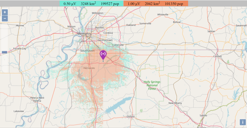
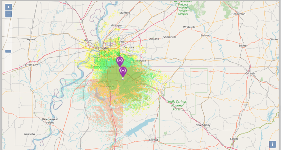
To create these maps, a great deal of data must be known about the repeater. It's geocoded location, elevation at ground level, height of structure upon which it is mounted, type of antenna (radiation pattern), db gain, length and type of feed line, output of the transmitter, loss due to duplexer, and feed-line, and a variety of other things. The software seems to be aware of the geography around the geocode you enter. These are estimates based on known information at the time and the accuracy of the software itself.
Use this only as a general rule of thumb. It is well known that the Craft Rd repeater transmits significantly further in the northerly direction than these maps might indicate.
Website - Radio Mobile
Combined Heat Map
Both Repeaters
Both Repeaters
Heat Map
2M Craft Rd. Repeater
2M Craft Rd. Repeater
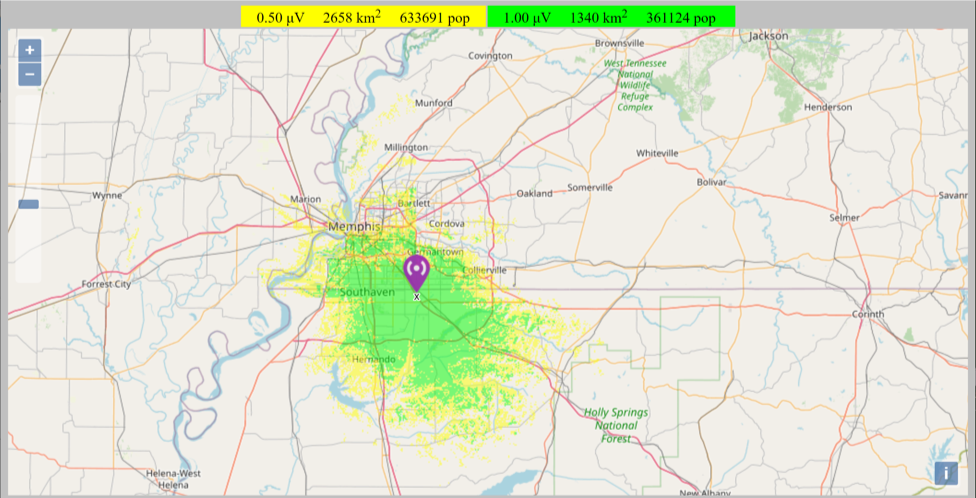
Heat Map
440 Repeater
440 Repeater